Hydrographic Survey
Precise Underwater Data for Better Projects
Get a Free Quote From Us Today!
We aim to get back to you in 24 hours.
At Hydrographic Survey, we specialise in capturing detailed bathymetric and positional data from underwater environments across the UK. Our services are essential for understanding the depths, features and conditions of water bodies for engineering, environmental and construction projects. We employ state-of-the-art technology to deliver precise and reliable results, helping our clients make informed decisions.
Contact us today for a free consultation.
Who Is Hydrographic Survey?
We’re Hydrographic Survey, experts in surveying underwater environments and water bodies. Our focus is on providing accurate bathymetric and positional data to inform various projects.
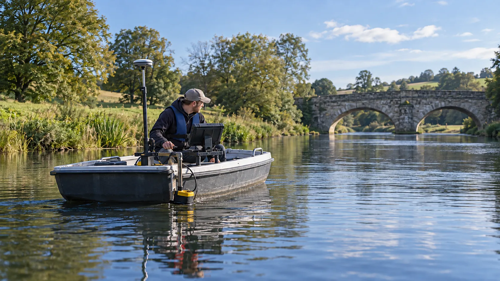
Using multibeam and single beam sonar systems, we can capture detailed images of the seafloor, ensuring precise depth measurements. Our GPS technology is integrated with real-time kinematic (RTK) systems to enhance positional accuracy, making us ideal partners for coastal development projects, dredging operations, and environmental monitoring.
We adhere to the standards set by the International Hydrographic Organization (IHO) to deliver reliable results. Our services benefit a range of clients, from harbour authorities to offshore energy companies, offering insights that support safe navigation and sustainable management of water resources.
If you require precise detail for your project, don’t hesitate to get in touch.
What Hydrographic Survey Services Does the company Hydrographic Survey Provide?
At Hydrographic Survey, we offer a range of services:
- Bathymetric Surveys: We measure the depth and shape of underwater terrain using sophisticated sonar technology. Our equipment includes multi-beam echosounders and single-beam sounders that deliver precise depth measurements, crucial for navigation safety and harbour management.
- Environmental Assessments: Our team evaluates underwater environments to support environmental protection efforts and compliance with regulations. We conduct water quality sampling, sediment analysis, and habitat mapping, ensuring adherence to industry standards such as the Water Framework Directive.
- Construction Support Surveys: We provide essential data for planning and executing marine and coastal construction projects. Services include pre-construction surveys to identify seabed conditions, as well as monitoring during construction to ensure structures are built to specifications.
- Positional Data Collection: Using GPS-guided equipment, we accurately capture positioning data crucial for various applications. This data assists in coastal management, pipeline tracking, and asset relocation, with precision ensured through Real-Time Kinematic (RTK) GPS technology.
Our services are designed to meet the varied needs of clients in sectors ranging from environmental agencies to construction and marine transportation. Reach out to explore how we can assist your project.
When Is Hydrographic Survey Needed?
Hydrographic surveys are needed when precise underwater data is vital for safety and planning. Before construction or engineering projects near water bodies, our surveys ensure safe and informed site selection.
For instance, bridge construction or dock installations rely on our bathymetric and seabed analysis, which help identify potential hazards such as submerged rocks or uneven topography. Environmental assessments require our services to monitor aquatic habitats, assisting in evaluating changes in aquatic ecosystems and preserving biodiversity.
Flood risk analysis depends on our accurate data, which aids in developing flood management strategies and assessing water flow patterns. Our surveys also play a crucial role in dredging operations by providing detailed sediment composition and depth information, ensuring navigational routes are well-maintained.
Whether for infrastructure development or environmental protection, our hydrographic surveys offer essential insights. Contact us to discuss your specific project needs.
Get a Free No Obligation Quotation Today
How Does Hydrographic Survey Work?
Here is how we approach each project:
- Initial Consultation: We engage with our clients to understand their specific needs and survey objectives. This assessment helps us determine the scope, timing, and precision required for the project, considering factors like water depth and seabed conditions.
- Planning and Preparation: Customising our equipment and approach to the site includes selecting appropriate sonar types, such as multibeam or single-beam echo sounders, and preparing vessels for efficient navigation. We also review local environmental conditions and regulations to ensure compliance with standards like the International Hydrographic Organization (IHO) S-44 guidelines.
- Data Collection: We use sonar and GPS systems to gather precise measurements of underwater topography. The use of Real-Time Kinematic (RTK) positioning ensures high accuracy in our data capture, essential for detailed bathymetric mapping.
- Data Analysis: Processing and interpreting the survey results involves using software to generate digital models and charts, which are crucial for applications like marine construction, navigation safety, or underwater archaeology.
- Reporting: We present comprehensive findings tailored to client requirements through detailed reports, interactive maps, and visualizations. Our deliverables are designed to assist clients in decision-making processes, whether for infrastructure projects or ecological assessments.
Ready to get started? Contact us to discuss your hydrographic survey needs.
Who Does Hydrographic Survey Help?
Hydrographic Survey assists a diverse client base by providing detailed and precise data essential for various projects and studies.
- Engineers planning infrastructure near water bodies benefit from our Bathymetric surveys, which map underwater topography crucial for designing bridges, ports, and pipelines.
- Environmental consultants conducting habitat studies use our data on sediment composition and current flow to assess ecosystems and plan conservation measures.
- Construction firms requiring site assessments rely on our Geophysical surveys, which identify underwater hazards and inform foundation designs.
- Government agencies involved in flood risk and waterway management use our River Flow measurements, helping them plan flood defences and manage navigable waterways effectively.
Each of these clients depends on accurate survey data to ensure project success and compliance with environmental standards. If you’re in need of our services, please get in touch.
How Quickly Can Hydrographic Survey Respond?
We tailor our response times to the urgency and scope of each project, considering factors such as location accessibility, equipment availability, and project complexity. Typically, we can commence surveys within one to two weeks, ensuring our clients receive timely and accurate data.
Our team uses precise GPS positioning and multi-beam echo sounders to gather detailed information quickly.
For more complex operations involving tidal currents and mobile seabeds, we may require additional preparation to ensure safety and accuracy. This includes obtaining necessary permits and mobilising specific equipment like side-scan sonar.
If you have urgent requirements, please contact us to discuss availability and explore how we can expedite the process to meet your deadlines.
Request a free quote
How Does Hydrographic Survey Ensure Quality and Compliance?
At Hydrographic Survey, quality is paramount. We adhere to industry best practices and employ equipment such as multi-beam echo sounders, which provide detailed underwater mapping for accurate data collection.
Our hydrographers are trained in data acquisition and processing methodologies, using software like AutoCAD and HydroMate to manage and interpret survey data effectively.
We ensure compliance with the International Hydrographic Organization (IHO) standards, including Special Publication S-44, which governs hydrographic data collection and quality control. Our team stays up-to-date with relevant regulations and British standards, consistently monitoring changes in maritime policies to maintain compliance in all aspects of our work.
By performing rigorous quality checks and validations, we provide reliable datasets for various applications, from coastal engineering projects to marine navigation systems. Our commitment to quality and compliance ensures precise results, meeting the exacting needs of our clients.
Why Choose Hydrographic Survey?
Choosing Hydrographic Survey means selecting a partner with expertise and dedication. Our advantages include:
- Advanced Technology: We employ sophisticated multi-beam and single-beam sonar systems, as well as Differential GPS to ensure precise depth and positioning measurements. Our equipment complies with IHO (International Hydrographic Organisation) standards for accuracy and consistency in surveying.
- Experienced Professionals: Our team comprises hydrographers with extensive experience in coastal and offshore surveys for various sectors, including oil and gas, maritime construction, and environmental monitoring. Our professionals are accredited by relevant industry bodies, ensuring they stay current with emerging methodologies.
- Comprehensive Reports: We provide detailed data analysis and presentation, incorporating bathymetric charts, contour maps, and digital surface models. Our reports adhere to NOAA (National Oceanic and Atmospheric Administration) standards, facilitating clear interpretation and application in maritime navigation.
- Client-Centric Approach: We offer tailored solutions to meet unique project needs, from site-specific risk assessments to project management consultations, ensuring alignment with clients’ operational goals and timelines.
By choosing Hydrographic Survey, you gain a reliable partner committed to delivering precise and actionable data for your marine and coastal projects.
Frequently Asked Questions
What is a hydrographic survey?
A hydrographic survey captures bathymetric and positional data from underwater environments. It helps in understanding water depths, terrain, and conditions needed for assessment and planning.
How long does a hydrographic survey take?
The duration varies with project scope and location. Typically, surveys can take a few days to several weeks, depending on the specific requirements and conditions.
What technology does Hydrographic Survey use?
We use sonar systems and GPS technology for precise depth measurement and mapping of underwater features. This combination ensures accurate and reliable data capture.
Get a Free Quote
Contact Hydrographic Survey for precise underwater data solutions tailored to your project needs. .
speak with our team today
What People are Saying About Us
★★★★★
“Very happy with Hydrographic Survey and the depth survey they did. Would use again.”
Oliver Okafor
London
★★★★★
“Our depth survey from Hydrographic Survey arrived on time and covered everything we needed. Really pleased with the outcome, no complaints at all.”
Priya Davies
London
★★★★★
“We needed an accurate survey of our lake before dredging. Hydrographic Survey handled it smoothly from first enquiry to final drawings, and I would happily recommend them.”
Charlotte Barker
London
★★★★★
“A really friendly and welcoming team at Hydrographic Survey, and I was thoroughly pleased with the whole experience.”
Stuart Rahman
London
Our Locations
We are proud to work nationally across the UK, allowing us to ensure we can provide services to you.
For a full list of counties we cover in the UK, see below.